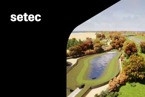
Planting design on a large project combining BIM, CAD, GIS and realistic rendering
In a "Full BIM" rail project, integrating the planting design was a challenge. The landscape team used 2D AutoCAD and Excel. A Civil 3D plug-in with planting databases and Extended Data allowed data to be attached to designs. This fusion with geometry created GIS models projected on surfaces. Populating these models resulted in BIM models in Civil 3D that could be used in Navisworks to create IFCs and realistic renderings in TwinMotion to streamline infrastructure design.