Optimizing the best railway route using AI and multicriteria analysis | Presentation
© 2025 Autodesk. All rights reserved.
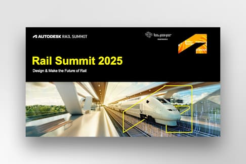
Design & Make the Future of Rail
Rail Summit 2025
About TPF
A diverse group of creative people, gathered in a client centric organization, enthusiastically building the world, better.
About TPF
+5,000 employees in 2023
326M€ revenue in 2024
+40 countries with active
projects
33% Women in 2024
Summary
• Image courtesy of [Name]
01
02
03
Contextualization of the Nova Ferroeste
Application of Artificial Intelligence in defining the route
BIM Model of Nova Ferroeste
Is Brazil a railway-oriented country?
Nova Ferroeste, why?
Building Information Modeling vs. Information Model for Decision-
Making
Model Result
Objectives achieved
Railway modeling in AutoCAD Civil 3D
Federated model of the Serra do Mar.
Summary
• Image courtesy of [Name]
01
02
03
Contextualization of the Nova Ferroeste
Application of Artificial Intelligence in defining the route
BIM Model of Nova Ferroeste
Is Brazil a railway-oriented country?
Nova Ferroeste, why?
Railway modeling in AutoCAD Civil 3D
Federated model of the Serra do Mar.
Building Information Modeling vs. Information Model for Decision-
Making
Model Result
Objectives achieved
• Is Brazil a railway- oriented country?
Is Brazil a railway- oriented country?
Mapa de Soja no Brasil
The center of gravity for cargo in Brazil is in
the Midwest and the western coastal states.
Is Brazil a railway- oriented country?
01
According to data from CNT, road transport
emits 101 gCO2/TKU compared to 23.3
gCO2/TKU for rail transport.
02
Freight transport by train offers: a lower
accident rate, reduced logistics costs, a
dramatic decrease in congestion, and shorter
transit times.
03
Transporting shorter-distance freight offers a
better quality of life for truck drivers. 04
• Is Brazil a railway- oriented country?
Is Brazil a railway- oriented country?
Yes.
• Is Brazil a railway- oriented country?
Nova Ferroeste, why?
Traffic High transportation
costs
High GHG
emissions
High number of
accidents
Logistics infrastructure in the region
One of the main grain export corridors in Brazil.
The connection to the Port of Paranaguá gives the corridor great potential for the distribution of imported fertilizers.
Main fuel import corridor for the interior of Paraná and other states.
Rail corridor with potential for container imports and integration into Paraguay's demographic belt.
Over 9 million people impacted.FEDERAL HIGHWAY NETWORK RAILWAY NETWORK
Interest Area
Summary
• Image courtesy of [Name]
01
02
03
Contextualization of the Nova Ferroeste
Application of Artificial Intelligence in defining the route
BIM Model of Nova Ferroeste
Is Brazil a railway-oriented country?
Nova Ferroeste, why?
Railway modeling in AutoCAD Civil 3D
Federated model of the Serra do Mar.
Building Information Modeling vs. Information Model for Decision-
Making
Model Result
Objectives achieved
• Is Brazil a railway-oriented country?
Building Information Modeling X Information modeling for decision-making
Building Information Modeling (BIM) is the digital
representation of a project’s physical and functional
characteristics, integrating data from multiple disciplines
to support design, construction, and operation throughout
its lifecycle.
In railway works, especially those of long extension,
Information Modeling for Decision-Making plays a
fundamental role — “where to build” takes priority over
“how to build”.
Information modeling
+ de 100 GB of geographic data (in a GIS environment) covering approximately 550.000 km².
Economic route, with low CAPEX and OPEX
Integrate stakeholders
Sustainable Rail Corridor
Information modeling General Objectives
IN FOUR MONTHS
Information modeling Multicriteria Analysis
1 Cultivated area
2 Agriculture GVA
3 Industrial GVA
4 Soy Production
5 Sugar Production
6 Wheat Production
7 Corn Production
8 Fertilizers Production
9 Petroleum and Derivatives
10 Meat and offal Production
11 Hidrographic Density
12 Slope of the Terrain
13 Geological Risk
14 Pluviometry
15 Proximity to Highways
16 Prox. to Competing Railways
17 Prox. to Connecting Railways
18 Warehouse Capacity
19 Attractive Ports
20 Competing Ports
21 Urban Areas
22 Education Index
23 Employment and Income Index
24 Fiscal Module
25 Indigenous Lands
26 Environmen. Conservation Unit
27 Sustainable Use Unit
28 Private Natur. Heritage Reserve
29 Environmental Protection Area
30 Caves
31 Quilombola Areas
32 Rural Settlements
33 Atlantic Forest Remnants
34 Protected Areas
35 Area of influen. of rural settlers
1. Defining which variables should be considered for the study of route alternatives
2. Grouping them into characteristic dimensions
3. Relating the variables to hierarchize them using the AHP method
4. Rasterizing, normalizing, and reclassifying the variable by assigning a score
5. Using map algebra, creating the final friction surfaces
6. Defining the favorability corridor
Weighted Linear Combination Process
Physical Socio-
environmental
Logistic
COST SURFACE
Commodity market
Socioeconomic
Study Dimensions
Dimension or Surface Area of Cost or Friction
Physical Dimension
Socioeconomic Dimension
Logistics Dimension
Commodity market Dimension
Socio-environmental dimension
Machine Learning
Implementation in ArcGIS
Machine Learning
+100 x
Various scenarios (input)
Various parameters (corridor)
Model Result
Image courtesy of [Name]
NEUTRAL SCENARIO
It considers all groups of factors in a more balanced way but considers the environmental factor as the primary dimension.
PHYSICAL SETTING
It prioritizes physical conditions over other groups of factors.
Favorability Corridors
Commodity market Dimension
• 10 variables
Physical Dimension
• 4 variables
Logistics Dimension
• 6 variables
Socio-environmental Dimension
• 11 variables
Socioeconomic Dimension
• 4 variables
TOTAL
• 35 variables
FRICTION SURFACES OF THE DIMENSIONS
DIMENSION RELATIVE WEIGHT
RANKING
Socio-environmental 32% 1
Physical 29% 2
Commodity market 21% 3
Logistics 14% 4
Socioeconomic 5% 5
Favorability Corridor
Heat Map of the Favorability Corridor
Region outside the favorability due to the use of an existing railway segment
Achieved goals
Image courtesy of [Name]
INTEGRATING STAKEHOLDERS
✓ Active participation in the process, especially in the weighting of variables;
✓ Construction of customized scenarios according to the client's preferences;
✓ Once the algorithm was completed, these scenarios were developed almost instantly.
ECONOMIC ROUTE, WITH LOW CAPEX AND OPEX.
✓ The engineering solutions were designed based on a structured and optimized foundation, rather than using a heterogeneous mass of data;
✓ After the model was created, the professionals worked on an area equivalent to 5% of the original territorial area.
SUSTAINABLE RAILWAY CORRIDOR
✓ The socio-environmental dimension was the study's priority;
✓ Additionally, it was the dimension with the highest number of variables (a total of 11);
✓ The railway is eligible for the issuance of green bonds.
Faithful adherence to the schedule – plan validated by stakeholders in 4 months.
Goals achieved with AI
Summary
• Im ag e courtesy of [Na me]
01
02
03
Contextualization of the Nova Ferroeste
Application of Artificial Intelligence in defining the route
BIM Model of Nova Ferroeste
Is Brazil a railway-oriented country?
Nova Ferroeste, why?
Railway modeling in AutoCAD Civil 3D
Federated model of the Serra do Mar.
Building Information Modeling vs. Information Model for Decision-
Making
Model Result
Objectives achieved
• Is Brazil a railway-oriented country?
Railway Modeling in AutoCAD Civil 3D
• Digital terrain model created using Recap;
• Geometric optimization of the route based on the
orthophoto mosaic across the entire length of the
route;
• Geometry and earthworks designed in Civil 3D for
the 1.304 km of the railway alignment;
• Identification and compensation of hundreds of cuts
and fills (half a billion m³) through an automated
process in Civil 3D, aimed at identifying the sources
and destinations that would result in the lowest
possible transportation moment.
Railway Modeling
Surface created through aerial photogrammetry
Orthophoto of the entire railway in Civil 3D
TPF Tools on the Civil 3D ribbon
Geometric Design in Civil 3D
Federated model of the Serra
do Mar in InfraWorks
Railway Modeling
Surfaces, corridors, and other elements
modeled in Civil 3D integrated into InfraWorks
• Is Brazil a railway-oriented country?
Federated model of the Serra do Mar (55 km Railway Segment)
Autodesk and the Autodesk logo are registered trademarks or trademarks of Autodesk, Inc., and/or its subsidiaries and/or affi liates in the USA and/or other countries. All other brand names, product names, or trademarks belong to their respective holders. Autodesk reserves the right to alter product and services offerings, and specifications and pricing at any time without notice, and is not responsible for typographical or graphical errors that may appear in this document. © 2025 Autodesk. All rights reserved.
30
Thank you
Seção Padrão Slide 1 Slide 2 Slide 3: Summary
Contextualization of the Nova Ferroeste Slide 4: Summary Slide 5 Slide 6 Slide 7 Slide 8 Slide 9 Slide 10
Artificial Intelligence in Nova Ferroeste Slide 11: Summary Slide 12 Slide 13 Slide 14 Slide 15 Slide 16 Slide 17 Slide 18 Slide 19: Model Result Slide 20 Slide 21 Slide 22: Achieved goals Slide 23
BIM Model of Nova Ferroeste Slide 24: Summary Slide 25 Slide 26 Slide 27 Slide 28 Slide 29 Slide 30