Civil 3D urban planning projects
Civil 3D was designed with both large-scale linear infrastructures and smaller-scale urban development projects in mind. How well-known is it among industry professionals?
VINCENT FREDON: It’s not well-known enough yet. Civil 3D
has long been used for major infrastructure projects such as
highways and railways. For a number of reasons, chief among
them market inertia, many urban planners are still using the
tools they’ve always had, which means they’re missing out on
the powerful new features that Civil 3D has to offer.
GUILLAUME BERSON: It also has to be said that Civil 3D has
evolved massively in recent years, as a result of considerable
investment. It’s now a multipurpose toolbox for planning
and modeling, whatever the project scale. It's an all-around
solution that works just as well for city centers as it does for
rail corridors.
You worked alongside a customer as part of a demonstration project, testing how Civil 3D can be put to use in urban planning.
Can you tell us the background to that? What conclusions did you reach?
VINCENT FREDON: Obviously, it wasn’t the first time Civil
3D had been used for urban planning. But on this particular
occasion, we really wanted to show what it could do.
The customer—a team from a major industry player in the
French and international markets—wanted to see how far Civil
3D could take them on a specific urban project. Two years ago
they approached us, because they didn’t have the resources
to explore all of Civil 3D’s capabilities on their own.
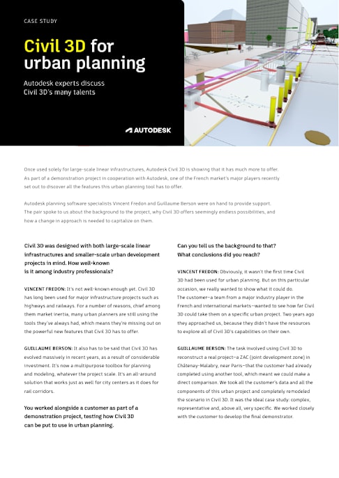
GUILLAUME BERSON: The task involved using Civil 3D to
reconstruct a real project—a ZAC (joint development zone) in
Châtenay-Malabry, near Paris—that the customer had already
completed using another tool, which meant we could make a
direct comparison. We took all the customer’s data and all the
components of this urban project and completely remodeled
the scenario in Civil 3D. It was the ideal case study: complex,
representative and, above all, very specific. We worked closely
with the customer to develop the final demonstrator.
Civil 3D for urban planning
CASE STUDY
Autodesk experts discuss Civil 3D’s many talents
Once used solely for large-scale linear infrastructures, Autodesk Civil 3D is showing that it has much more to offer.
As part of a demonstration project in cooperation with Autodesk, one of the French market’s major players recently
set out to discover all the features this urban planning tool has to offer.
Autodesk planning software specialists Vincent Fredon and Guillaume Berson were on hand to provide support.
The pair spoke to us about the background to the project, why Civil 3D offers seemingly endless possibilities, and
how a change in approach is needed to capitalize on them.
Their feedback was really positive. In addition to seeing
for themselves that Civil 3D can achieve the same results,
they’re now developing their own methods so they can use it
on their own. Data from the project will soon be available to
other users for demonstration purposes.
Which Civil 3D functions did you use?
GUILLAUME BERSON: Naturally, we used the classic
infrastructure modeling functions, such as public highways,
plus connections to main roads and the existing road
network, as well as more specific urban planning tools
including on-site roadways, plazas, footpaths, and cycle
paths, which are often more complex.
This project featured a landscaped area that crossed the
main road, with elements such as stairways, ramps, low walls,
and split levels. Thanks to Civil 3D, we were able to manage
this geometric complexity. There were also underground
networks to address, including stormwater systems, gravity
and pressure networks, and dry networks such as electricity
and telecommunications.
VINCENT FREDON: Thanks to the integration of AutoCAD
and AutoCAD Architecture into Civil 3D, many additional
functions beyond core infrastructure tools can be used to
enhance designs. That’s something the demo project really
benefited from. With Civil 3D also being integrated into the
AEC Collection, it allows more seamless interaction with
other solutions such as Revit, Navisworks, and the ACC
collaborative platform.
Have you noticed any differences in how the software is used and major civil engineering and infrastructure projects? And are there any differences compared to the tools that the customer has been using up to now?
VINCENT FREDON: When it comes to urban planning,
approaches based on cross-sectional and longitudinal
profiles can’t cover every need. Plazas, gardens, and
footpaths require more flexible modeling tools.
Civil 3D lets customers combine different methods
combined to cover all requirements. The results are entirely
satisfactory, but in ways that may seem a little abstract to
anyone used to working with other software.
When you use Civil 3D for urban planning projects, what changes in the way you go about things?
VINCENT FREDON: Integration into the Autodesk ecosystem
is a real asset. It means teams can carry on using the tools
they’re familiar with, while working together more effectively
in the cloud. Data exchange is fluid, project reviews are easier,
and everyone can work together in the same environment.
GUILLAUME BERSON: What really impressed the
customer was the ability to publish data in a common data
environment, or CDE, which can be accessed from a browser.
You can even view the project in 2D and 3D, in real time,
without having to install any software.
All stakeholders have access to updated files and can
comment on or amend them. There’s total transparency both
in-house and in dealings with the customer. Some tasks can
also be automated thanks to API. And bringing AI into the
process makes things even easier.
In terms of the demo project, were requirements relating to the BIM process met?
GUILLAUME BERSON: Yes, absolutely. Civil 3D’s native format
is DWG, but it handles IFC file imports really well and can
export IFC files too. This is especially useful for customers
with BIM obligations, especially if they’re working with public
sector clients. This degree of flexibility allows them to meet
every requirement in the specifications.
Every tool has its own specific features, and to make the most of Civil 3D’s, you have to start from scratch. But once you've managed to change your approach and look at this tool with an open mind, you'll find a host of extremely powerful features.
–Vincent Fredon Solution Engineer AEC, Autodesk
Did your customer know that Civil 3D was already listed among the Autodesk tools to which they have access?
VINCENT FREDON: Yes, they have an Enterprise Business
Agreement, or EBA, and they knew that Civil 3D formed part of
the agreement. However, while the team heading up the project
does work in linear infrastructure, they specialize in urban
planning and had only a partial understanding of Civil 3D.
GUILLAUME BERSON: What surprised them was that Civil
3D can manage the entire workflow, from design through to
detailed modeling. Many customers who are AEC Collection
subscribers still don’t know that it includes Civil 3D, which is
a shame because they’re missing out on a very powerful tool
that’s theirs already.
What would you say to customers in the urban sector who want to switch to Civil 3D?
VINCENT FREDON: My first piece of advice would be to take
a fresh look at Civil 3D. The second is to do some testing
and create a proof of concept rather than dive straight into
a new project.
And above all, ask for help. We have a lot of resources
at Autodesk, including training courses, videos,
documentation in French, and forums, and our partners are
there to support you too. For more information, click here.
GUILLAUME BERSON: You don’t have to give up everything
for Civil 3D. Start by using it on certain types of project,
along with other tools, and then gradually extend it to
other projects. This will help you keep additional software
licensing costs down. Many customers start out this way
and end up doing everything in Civil 3D themselves.
GUILLAUME BERSON
As an AEC technical specialist at Autodesk, Guillaume helps
infrastructure stakeholders discover, understand, and adopt
innovative solutions from the AEC Collection by sharing his
expertise through articles, videos, and demonstrations.
VINCENT FREDON
Vincent has been an infrastructure solution engineer at
Autodesk for more than ten years. He helps customers use
design, modeling, and collaboration tools so they can meet their
challenges, optimize their methods, and be more productive.
THE EXPERTS
Autodesk, the Autodesk logo, AutoCAD, Revit, Navisworks, and Civil 3D are registered trademarks of Autodesk, Inc., and/or its subsidiaries and/or affiliates in the United States and/or other countries. All other brand names, product names, or trademarks are the property of their respective owners. Autodesk reserves the right to change its product and service offerings, product specifications, and pricing at any time without notice. Autodesk is not responsible for any typographical or graphical errors that may appear in this document. © 2025 Autodesk, Inc. All rights reserved.
Civil 3D has a limitless number of tools and virtually infinite capabilities. Once you get started, the rest flows naturally.
–Guillaume Berson Solution Engineer AEC, Autodesk
Discover Civil 3D
https://www.autodesk.com/fr/campaigns/formation-civil-3d?msockid=0692ff1371196d7e1b7deaec70f26c52 https://boards.autodesk.com/civil-3d-urban-planning